Steve and Diana Lincoln
Call or Text Steve: (760) 707-6033
Call or Text Diana: (760) 707-6034
Follow Us
687 Perkins, California City, CA 93505
Bedrooms: 0
Bathrooms: 0
Area: 0 SqFt.


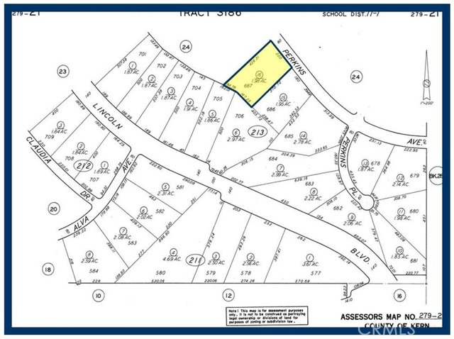
Lot 687 Map 3186, 1.98 Acres, (Apn: 279-213-16-001) GPS: 35.2107, -117.79431 on Perkins Ave in California City, CA. California City is 18 miles northwest of Edwards Air Force Base, 40 miles north of Lancaster and 28 miles east of Tehachapi. The property is 0.3 miles south of Rutgers Rd and 1.5 miles north of 20 Mule Team Pkwy. California City has zoned this property as R4 Residential. According to the City the following uses are permitted: Single Family Dwellings, riding stables, corrals and animal keeping. No utilities are currently available to this lot. Electricity is approx 1 mile east. Please check with the City for water and sewer distance. Use the GPS coordinates to locate the property. GPS: 35.2107, -117.79431
CA DRE #01870580
 6965 El Camino Real 105-690, Carlsbad CA 92009
![]() 877.692.8427
877.692.8427


This information is deemed reliable but not guaranteed. You should rely on this information only to decide whether or not to further investigate a particular property. BEFORE MAKING ANY OTHER DECISION, YOU SHOULD PERSONALLY INVESTIGATE THE FACTS (e.g. square footage and lot size) with the assistance of an appropriate professional. You may use this information only to identify properties you may be interested in investigating further. All uses except for personal, non-commercial use in accordance with the foregoing purpose are prohibited. Redistribution or copying of this information, any photographs or video tours is strictly prohibited. This information is derived from the Internet Data Exchange (IDX) service provided by Sandicor®. Displayed property listings may be held by a brokerage firm other than the broker and/or agent responsible for this display. The information and any photographs and video tours and the compilation from which they are derived is protected by copyright. Compilation © 2017 Sandicor®, Inc.
© Copyright 2025 Lincoln Realty Group. Powered by 
One fine body…